
An update released by Rio Grande National Forest as of Monday, July 20 stated that the Schrader Creek fire has been more successfully mapped and is at nine acres and showing minimal fire behavior.
This item is available in full to subscribers.
To continue reading, you will need to either log in to your subscriber account, below, or purchase a new subscription.
Please log in to continue |


lferrell@alamosanews.com
DEL NORTE— An update released by Rio Grande National Forest as of Monday, July 20 stated that the Schrader Creek fire has been more successfully mapped and is at nine acres and showing minimal fire behavior.
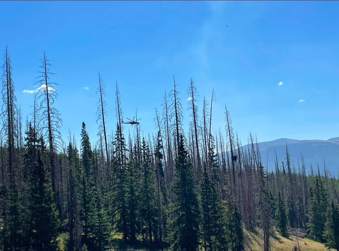
Emergency personnel are closely monitoring the developing wildfire incident on the western edge of the San Luis Valley. The blaze was reported Sunday afternoon around 2 p.m. and has placed local hotshot crews and regional fire rescue teams on high alert as southern Colorado faces a multi-day stretch of critical fire weather. There continues to be firefighting resources working to contain the fire.
The incident comes at a time of extreme vulnerability for the region. The Bureau of Land Management and the U.S. Forest Service recently enacted strict Stage 2 fire restrictions across Alamosa, Rio Grande, Saguache, Mineral, Conejos, and Costilla counties. Record-low fuel moisture levels, coupled with high temperatures and unpredictable afternoon wind gusts, have made the high-altitude terrain incredibly receptive to rapid fire growth.
This also comes at a time when Colorado is currently fighting several fires, making resources and water in short supply. South Fork Fire Rescue confirmed on Sunday that the Nation is at a preparedness level 5 or PL-5.
According to The National Interagency Fire Center it states, “National resources are heavily committed, and additional measures are taken to support geographic areas. Active geographic areas must take emergency measures to sustain incident operations. Inactive/low activity geographic areas are reaching drawdown levels.”
For long-term residents of South Fork and the broader San Luis Valley, the sight of fresh smoke rising against the Continental Divide has sparked immediate concern. The current environmental conditions closely mirror those of June 2013, when the catastrophic West Fork Complex Fire tore through the region.
Ignited by lightning, the 2013 West Fork Complex eventually ballooned into a massive three-fire inferno—comprising the West Fork, Papoose, and Windy Pass blazes—that scorched 109,615 acres of public and private land. Fueled by dense stands of timber killed by a sweeping spruce beetle epidemic, the fire exhibited explosive, unpredictable behavior that defied direct containment efforts for weeks.
The 2013 disaster forced the complete evacuation of the town of South Fork and nearby Wagon Wheel Gap, choking the valley in dense smoke and shutting down U.S. Highway 160 and State Highway 149. While aggressive structure protection successfully saved the town’s core from burning, the fire dealt a devastating multi-million-dollar blow to the local tourism economy and permanently altered the landscape of the Rio Grande National Forest.
Initial attack crews are utilizing a combination of ground resources and aerial reconnaissance to "squeeze the box" on the active fire perimeter before shifting winds can push the flames closer to populated subdivisions.
Fire officials are urging all residents and visitors to strictly adhere to the active fire bans, noting that violations on federal land carry severe penalties, including fines up to $100,000 and 12 months of imprisonment. Property owners are advised to maintain situational awareness, monitor local emergency management channels, and ensure their evacuation checklists are ready.
Updates for the Schrader Fire can be viewed on Facebook at Rio Grande National Forest or by following South Fork Fire Rescue or Valley Courier Regional News.


