
SOUTH FORK — With the Town of South Fork being nestled into the heart of the San Juan and La Garita mountain ranges, it is a wonderful place to be during the changing of the seasons, especially fall. Using the town as a starting point for some beautiful fall drives leads travelers through the high mountain highways that offer spectacular views of the changing trees as they shift into their fall colors.
The South Fork Visitor Center is offering free fall drive maps that will take travelers through some gorgeous areas that offer every opportunity to get out and take pictures, take a short hike or meander through Aspen groves that are sure to take your breath away with every turn.
Platoro Lake is a gorgeous high mountain lake nestled in the San Juan Mountains just a short walk from the main trailhead. Take Park Creek Road (Forest Service Road 380) toward Summitville. Take the turn to Ellwood Pass which will take you into Platoro. On the way down the pass, you will drive through the canopies of Aspen and have incredible views in all directions. There is a Lodge in Platoro that serves delicious burgers, among other things. The trip is around 40 miles one way and should take around two hours.
Travelers can also head towards the historic town of Lake City to experience the Silver Thread Historic Scenic Byway. Take the Silver Thread Highway (149) from South Fork to Lake City for spectacular views of mountains and a patchwork of color. Be sure to stop at North Clear Creek Falls. Look for bear prints in the mud of North Clear Creek.
Pool Table and Wheeler Geologic Area is a beautiful drive in the La Garita Mountains just before Creede. Take the Silver Thread Highway (149) toward Creede. Just past Cottonwood Cove, there will be a sign that says, “Pool Table”. It is Forest Service Road 600 and is 14 miles. Travelers may take a two-wheel-drive vehicle to Hanson’s Mill then take the hiking trail up 6.5 miles to the geologic area. After the mill, you will need a four-wheel-drive vehicle. Drive on top of the mesa to be surrounded by golden Aspen.
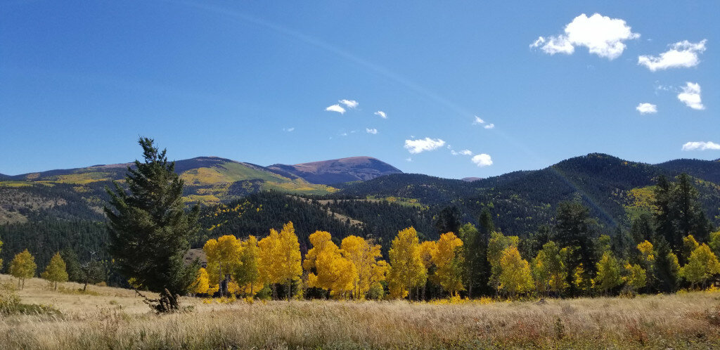
Beaver Creek Road is a short distance from South Fork and a great place to view fall colors. Take Highway 160 west 3 miles to Beaver Creek Reservoir Road. This is Forest Service Road 360. The first 5-7 miles are through an Aspen forest. You will pass through the pines, then the spruce and fir for great views of the surrounding mountains.
Willow Creek and Del Norte Peak are 17 miles south of South Fork near the town of Del Norte. Head two miles east of town on Highway 160 to Gerrard Road. This is Forest Service Road 350, also known as Willow Creek Road. You may follow it south up to the junction of road 345where you will turn back to the northeast then meander back to the northwest around Del Norte Peak for beautiful views of the mountain.
To get a map of the fall drives described above, please visit the South Fork Visitor Center located at the intersection of Highway 149 and 160 in South Fork.


